


Discover the Ultimate Outdoor Navigation with South Africa Topo Maps!
Are you an outdoor enthusiast looking for the best navigation solution for your adventures in South Africa? Look no further! The South Africa Topo Maps app is your go-to solution for easy and effective outdoor navigation. With free access to the best available maps and aerial imagery, this app is perfect for hikers, bikers, campers, climbers, and anyone who loves the great outdoors!
What Makes South Africa Topo Maps Stand Out? ️
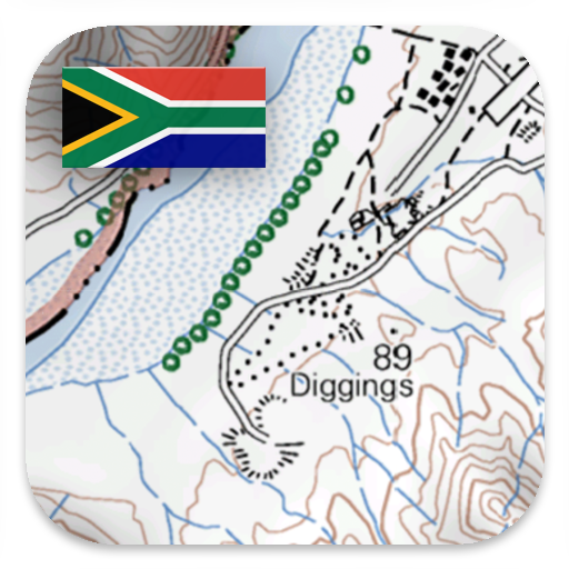
Unlike many other navigation apps that rely on OpenStreetMaps or commercial map providers, South Africa Topo Maps utilizes the 1:50,000 topographical maps provided by the National Geospatial Information (NGI), South Africa’s national mapping organization. These maps show significantly more tracks, paths, and features than the maps you may find elsewhere. With a total of 1,913 sheets, the 1:50,000 topographical maps offer full coverage of South Africa, ensuring that you won’t miss any hidden gems during your outdoor adventures.
Extensive Map Availability
The South Africa Topo Maps app provides a comprehensive selection of map layers, including:
- South Africa Topo Maps: Featuring NGI’s 1:2,000,000, 1:250,000, and 1:50,000 topographical maps.
- South Africa Aerial Imagery: Enjoy high-resolution images with a ground resolution of 50cm/pixel.
- Worldwide Basemap Layers: Access a variety of basemap layers such as:
- OpenStreetMaps with 5 different layouts
- Google Maps (Satellite, Road, and Terrain)
- Bing Maps (Satellite and Road)
- ESRI Maps (Satellite, Road, and Terrain)
- Waze Roads
- Earth At Night
Customize Your Navigation Experience
One of the standout features of the South Africa Topo Maps apk is the ability to configure a base map layer as an overlay. You can utilize a transparency fader to seamlessly compare maps with each other, allowing you to find the most interesting routes. If you have maps from other sources, you can easily import them in GeoPDF, GeoTiff, MBTiles, or Ozi formats. The app also supports web mapping services like WMS or WMTS/Tileserver, making it incredibly versatile!
Powerful Outdoor Navigation Features ♂️
With a focus on outdoor navigation, the South Africa Topo Maps app comes packed with features that enhance your outdoor experience:
- Download Map Data for Offline Usage: Never worry about losing signal in remote areas! Download maps and use them offline.
- Measure Paths and Areas: Plan your route effectively by measuring distances and areas.
- Create and Edit Waypoints: Mark specific locations along your route for easier navigation.
- GoTo-Waypoint Navigation: Navigate directly to your desired waypoint with ease.
- Create and Edit Routes: Customize your journey by creating tailored routes.
- Track Recording: Capture your journey with speed, elevation, and accuracy profiles.
- Tripmaster: Keep track of your odometer, average speed, bearing, elevation, and more.
- GPX/KML/KMZ Import/Export: Easily manage your GPS data and share it with others.
- Customizable Data Fields: Personalize your map view and tripmaster with data fields like speed, distance, and compass.
- Share Waypoints, Tracks, or Routes: Use email, Dropbox, WhatsApp, and more to share your adventures.
Ideal for All Outdoor Activities
Whether you’re hiking, biking, camping, climbing, skiing, canoeing, hunting, or going on off-road 4WD tours, the South Africa Topo Maps app is designed to meet all your navigation needs. With the ability to add custom waypoints in various formats, including longitude/latitude, UTM, and MGRS/USNG, you can ensure precise navigation wherever your adventures take you.
Elevate Your Outdoor Experience with Enhanced Features
The app’s NGI topographic maps are enhanced with Atlogis® hill shading and placenames, providing you with a clearer understanding of the terrain. The South Africa Topo Maps app allows you to toggle between different map layers or use the compare maps feature to find the best routes. This flexibility is especially valuable for discovering small paths or other features that may be missing from modern maps.
Get Started with South Africa Topo Maps Today!
Ready to elevate your outdoor navigation experience? Download the latest version of the South Africa Topo Maps app for free right here on MobileGag! Enjoy all the incredible features that this app has to offer. Whether you’re planning a weekend hike or a multi-day camping trip, the South Africa Topo Maps app will help you navigate with confidence.
️ Download South Africa Topo Maps now for free and embark on your next adventure with the best navigation tool at your fingertips!
For any questions, comments, or feature requests, feel free to reach out to us at support@atlogis.com. Your adventure awaits! Happy exploring!


You must be logged in to post a comment.